File:NSRW Dominion of Canada and Newfoundland.jpg
Original file (2,607 × 1,909 pixels, file size: 2.23 MB, MIME type: image/jpeg)
| This is a file from the Wikimedia Commons. Information from its description page there is shown below. Commons is a freely licensed media file repository. You can help. |
Summary
| Description |
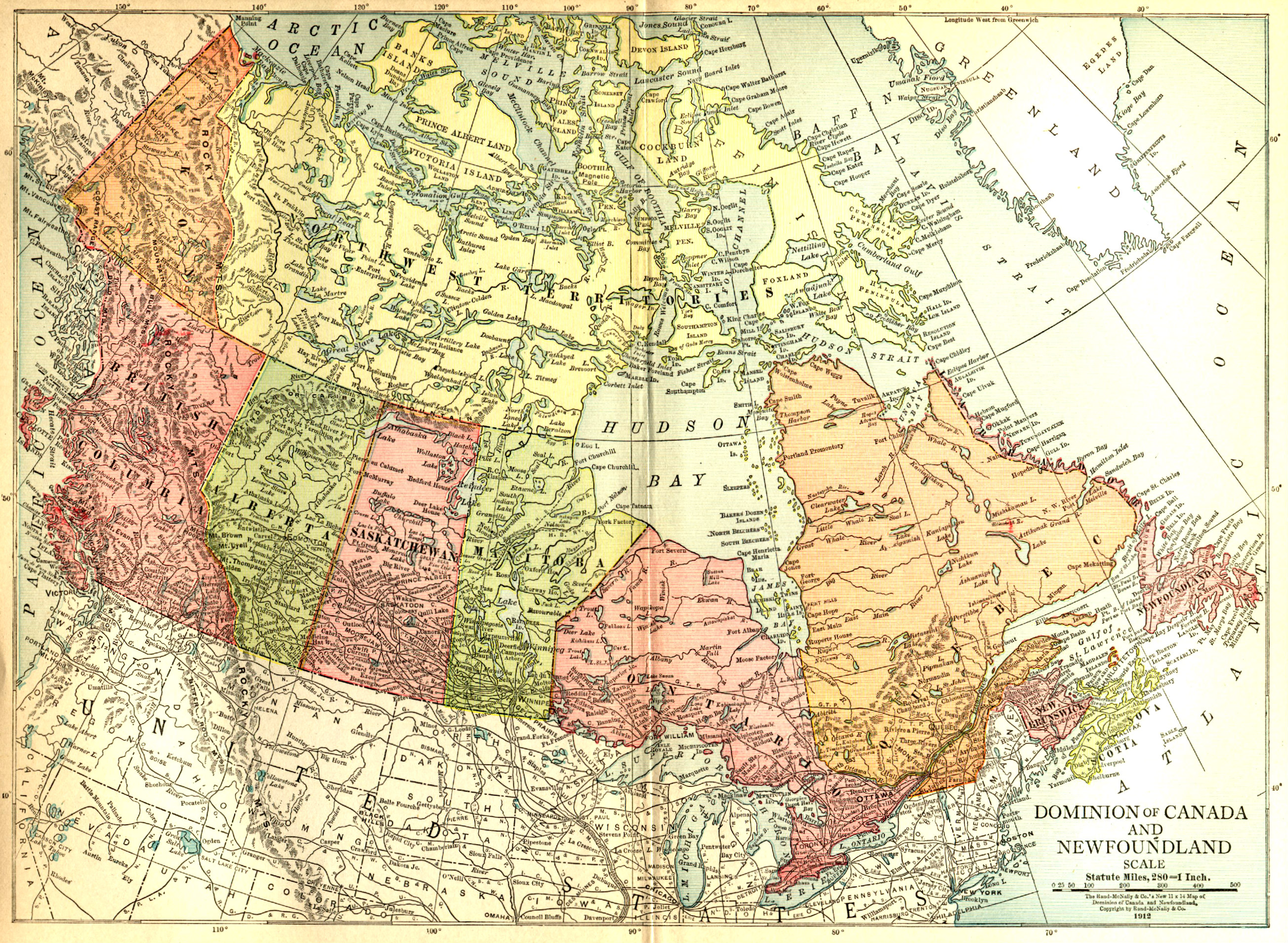
English: Map of Dominion of Canada and Newfoundland. |
||||
| Date | |||||
| Source |
|
||||
| Author | Rand-McNally & Co. | ||||
| Permission (Reusing this file) |
|
||||

File history
Click on a date/time to view the file as it appeared at that time.
| Date/Time | Thumbnail | Dimensions | User | Comment | |
|---|---|---|---|---|---|
| current | 19:14, 30 August 2018 | | 2,607 × 1,909 (2.23 MB) | Bob Burkhardt | {{Information |description ={{en|1=Map of Dominion of Canada and Newfoundland.}} |date =1912 |source ={{ExtractedFromNSRW|LA2-NSRW-1-0374.jpg}} |author =Rand-McNally & Co. |permission ={{PD-old-auto-1923|deathyear=1936}} }} Category:Old maps of Canada Category:Old maps of Newfoundland |
File usage
The following 2 pages use this file: